|
تضامنًا مع حق الشعب الفلسطيني |
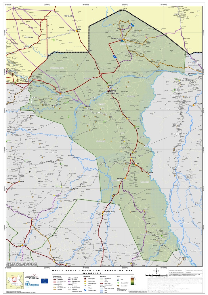
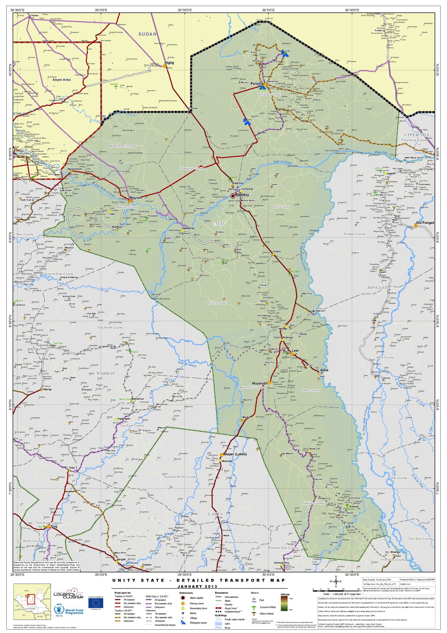
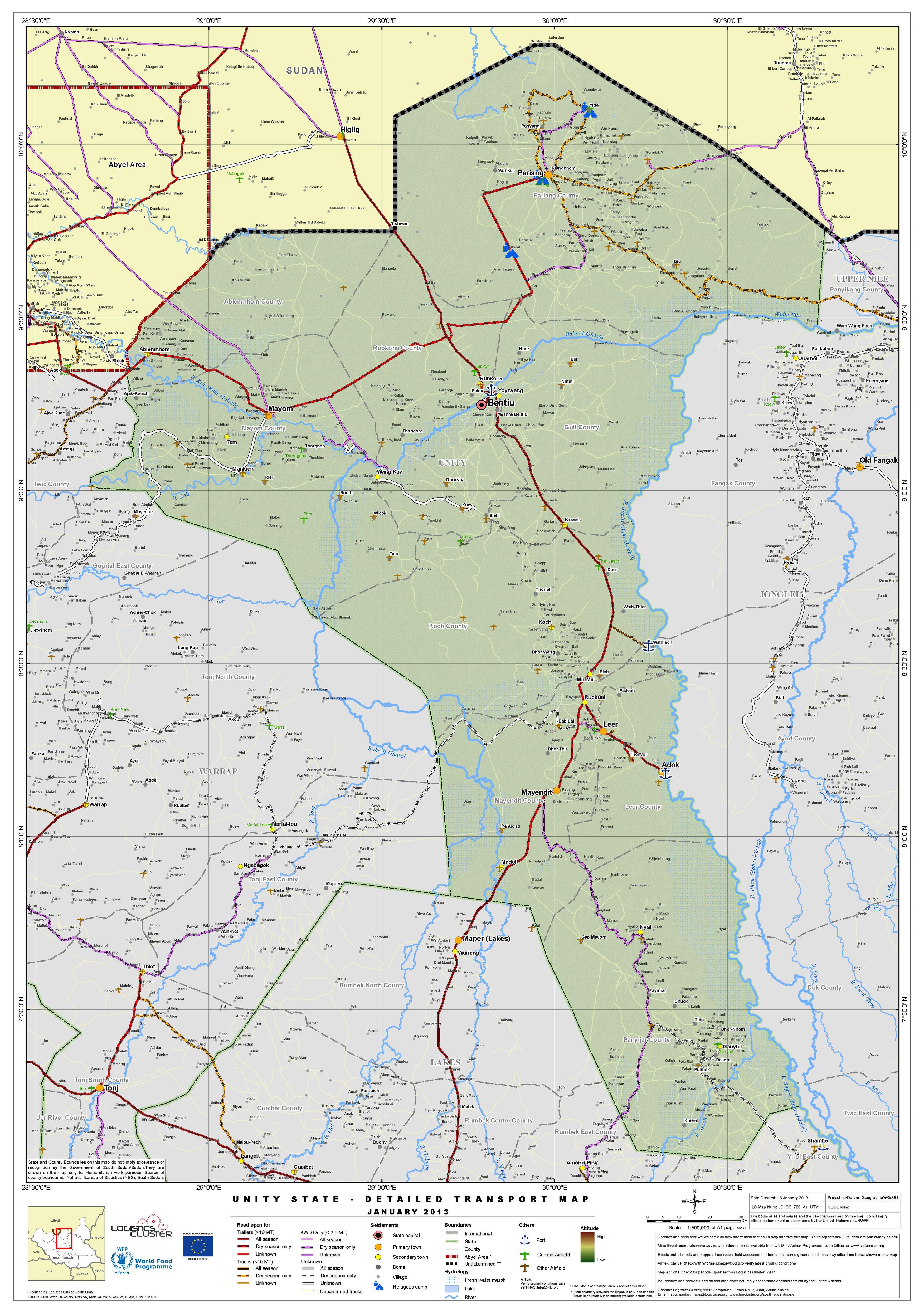
ملف:South Sudan Unity State - Detailed Transport Map Jan 2013.pdf
الملف الأصلي (3٬506 × 4٬966 بكسل حجم الملف: 6٫82 ميجابايت، نوع MIME: application/pdf)
| هذا ملف من ويكيميديا كومنز. معلومات من صفحة وصفه مبينة في الأسفل. كومنز مستودع ملفات ميديا ذو رخصة حرة. |
ملخص
| الوصف |
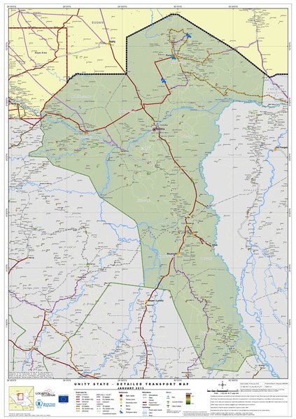
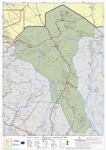
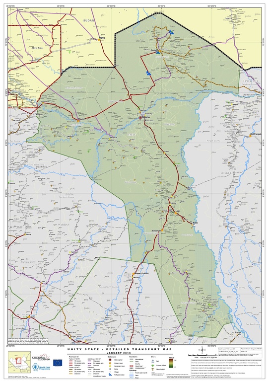
English: Transport map of Unity State (January 2013) |
| التاريخ | |
| المصدر | http://reliefweb.int/sites/reliefweb.int/files/resources/South%20Sudan%20Unity%20State%20-%20Detailed%20Transport%20Map%20%20Jan%202013.pdf |
| المؤلف | United Nations World Food Programme |
ترخيص
| This image is a map derived from a United Nations map.
Unless stated otherwise, UN maps are to be considered in the public domain. This applies worldwide. UN maps are, in principle, open source material and you can use them in your work or for making your own map. UN requests however that you delete the UN name, logo and reference number upon any modification to the map. Content of your map will be your responsibility. You can state in your publication, if you wish, something like: based on UN map … (map name, map number, revision number and date). See: Geospatial Information Section. And: Geospatial, location data for a better world. |
 |
تاريخ الملف
اضغط على زمن/تاريخ لرؤية الملف كما بدا في هذا الزمن.
| زمن/تاريخ | صورة مصغرة | الأبعاد | مستخدم | تعليق | |
|---|---|---|---|---|---|
| حالي | 05:09، 21 فبراير 2017 |  | 3٬506 × 4٬966 (6٫82 ميجابايت) | commonswiki>Wnt | User created page with UploadWizard |
استخدام الملف
ال1 ملف التالي مكررات لهذا الملف (المزيد من التفاصيل):
- ملف:South Sudan Unity State - Detailed Transport Map Jan 2013.pdf من ويكيميديا كومنز
الصفحة التالية تستخدم هذا الملف: