|
تضامنًا مع حق الشعب الفلسطيني |
ملف:Quebec - Arrondissements.svg
اذهب إلى التنقل
اذهب إلى البحث

حجم معاينة PNG لذلك الملف ذي الامتداد SVG: 623 × 600 بكسل. الأبعاد الأخرى: 249 × 240 بكسل | 498 × 480 بكسل | 798 × 768 بكسل | 1٬063 × 1٬024 بكسل | 2٬127 × 2٬048 بكسل | 1٬133 × 1٬091 بكسل.
الملف الأصلي (ملف SVG، أبعاده 1٬133 × 1٬091 بكسل، حجم الملف: 26 كيلوبايت)
| هذا ملف من ويكيميديا كومنز. معلومات من صفحة وصفه مبينة في الأسفل. كومنز مستودع ملفات ميديا ذو رخصة حرة. |
ملخص
| الوصف |
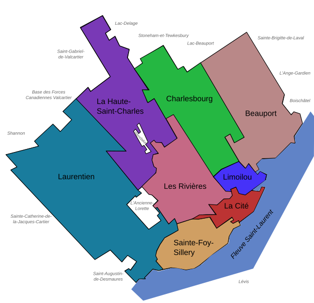
Français : Carte des arrondissements de la ville de Québec (Québec, Canada) en 2007.
English: Maps of the Boroughs ("Arrondissements") of Quebec City (Quebec, Canada), 2007. |
||
| التاريخ | |||
| المصدر | Own work, made with Inkscape | ||
| المؤلف | User:Boréal | ||
| الترخيص (إعادة استخدام هذا الملف) |
|
||
| إصدارات أخرى |
Version modifiée illustrant les arrondissements le 1er novembre 2009 Modified version illustrating the boroughs on November 1, 2009 |

تاريخ الملف
اضغط على زمن/تاريخ لرؤية الملف كما بدا في هذا الزمن.
| زمن/تاريخ | صورة مصغرة | الأبعاد | مستخدم | تعليق | |
|---|---|---|---|---|---|
| حالي | 22:28، 16 مايو 2008 | | 1٬133 × 1٬091 (26 كيلوبايت) | commonswiki>Essin | Spelling edit: Stoneham-et-Tewksbury -> Stoneham-et-Tewkesbury |
استخدام الملف
ال1 ملف التالي مكررات لهذا الملف (المزيد من التفاصيل):
- ملف:Quebec - Arrondissements.svg من ويكيميديا كومنز
الصفحة التالية تستخدم هذا الملف: