وحدة:Location map/data/Croatia
| الاسم | Croatia | |||
|---|---|---|---|---|
| احداثيات الجوانب | ||||
| 46.8 | ||||
| 13.1 | ←↕→ | 19.9 | ||
| 42.1 | ||||
| وسط الخريطة | 44°27′N 16°30′E / 44.45°N 16.5°E | |||
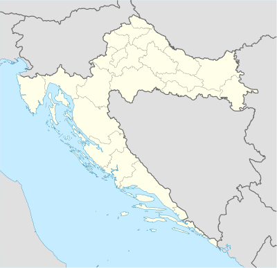
| صورة image | Croatia_location_map.svg
| |||

| ||||
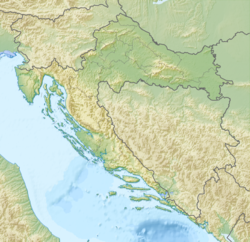
| صورة1 image1 | Croatia relief map.png
| |||

| ||||
| صورة2 image2 | Relief map of Croatia.png
| |||

| ||||

وحدة:Location map/data/Croatia هي خريطة موقع تستعمل لتركيب علامات وتسميات في an إسقاط متساوي المستطيلات خريطة Croatia. يتم وضع العلامات بواسطة احداثيات خطي العرض والطول في صورة الخريطة الافتراضية، أو صورة خريطة مماثلة.
الاستخدام
These definitions are used by the following templates when invoked with parameter "Croatia":
{{خريطة مواقع| Croatia | ...}}{{Location map many| Croatia | ...}}{{خريطة مواقع+| Croatia | ...}}{{خريطة مواقع~| Croatia | ...}}
تعريف الخريطة
name = Croatia- الاسم المستخدم في التسمية التوضيحية للخريطة الافتراضية
image = Croatia_location_map.svg- الصورة الافتراضية دون "Image:" أو "صورة:" أو "File:" أو "ملف:"
image1 = Croatia relief map.png- An alternative map image, usually a relief map, can be displayed via the relief or AlternativeMap parameters
image2 = Relief map of Croatia.png- A second alternative map image, can be displayed via the AlternativeMap parameter only
top = 46.8- عرض جغرافي at top edge of map, in decimal degrees
bottom = 42.1- Latitude at bottom edge of map, in decimal degrees
left = 13.1- طول جغرافي at left edge of map, in decimal degrees
right = 19.9- Longitude at right edge of map, in decimal degrees
خريطة بديلة
The map defined as image1 (Croatia relief map.png) can be displayed by using the relief or AlternativeMap parameters in {{خريطة مواقع}}, {{Location map many}} and {{خريطة مواقع+}}. The map defined as image2 (Relief map of Croatia.png) can only be displayed by using the AlternativeMap parameter. The use of these two parameters is shown in the examples below. Additional examples can be found at:
الدقه
طول جغرافي: from West to East this map definition covers 6.8 degrees.
- At an image width of 200 بكسلs, that is 0.034 degrees per pixel.
- At an image width of 1000 pixels, that is 0.0068 degrees per pixel.
عرض جغرافي: from North to South this map definition covers 4.7 degrees.
- At an image height of 200 pixels, that is 0.0235 degrees per pixel.
- At an image height of 1000 pixels, that is 0.0047 degrees per pixel.
أمثلة على استخدام قوالب خريطة الموقع
Location map, using default map (image)
{{خريطة مواقع| Croatia
| width   = 250
| lat_deg = 45.82
| lon_deg = 15.98
| label   = Zagreb
}}
Location map many, using relief map (image1)
{{Location map many| Croatia
| relief   = yes
| width    = 250
| caption  = Two locations in Croatia
| lat1_deg = 45.82
| lon1_deg = 15.98
| label1   = Zagreb
| lat2_deg = 45.35
| lon2_deg = 19.00
| label2   = Vukovar
}}
Location map+, using AlternativeMap
{{خريطة مواقع+| Croatia
| AlternativeMap = LocationmapCroatia.png
| width   = 350
| caption = Three locations in Croatia
| places  =
  {{خريطة مواقع~| Croatia
  | lat_deg    = 45.82
  | lon_deg    = 15.98
  | label      = Zagreb
  | background = lightgreen
  | mark       = Green_pog.svg
  }}
  {{خريطة مواقع~| Croatia
  | lat_deg    = 45.35
  | lon_deg    = 19.00
  | label      = Vukovar
  | background = orange
  | mark       = Orange_pog.svg
  }}
  {{خريطة مواقع~| Croatia
  | lat_deg    = 42.64
  | lon_deg    = 18.11
  | label      = Dubrovnik
  | background = yellow
  | mark       = Yellow_pog.svg
  }}
}}
أنظر أيضا
- قوالب خريطة الموقع
- قالب:خريطة مواقع، لعرض علامة واحدة وتسمية باستخدام خطوط الطول والعرض.
- قالب:Location map many، لعرض ما يصل إلى تسع علامات وملصقات.
- قالب:خريطة مواقع+،لعرض عدد غير محدود من العلامات والملصقات.


