|
تضامنًا مع حق الشعب الفلسطيني |
ملف:Spanish-virgin-islands.jpg
اذهب إلى التنقل
اذهب إلى البحث
Spanish-virgin-islands.jpg (648 × 453 بكسل حجم الملف: 30 كيلوبايت، نوع MIME: image/jpeg)
تاريخ الملف
اضغط على زمن/تاريخ لرؤية الملف كما بدا في هذا الزمن.
| زمن/تاريخ | صورة مصغرة | الأبعاد | مستخدم | تعليق | |
|---|---|---|---|---|---|
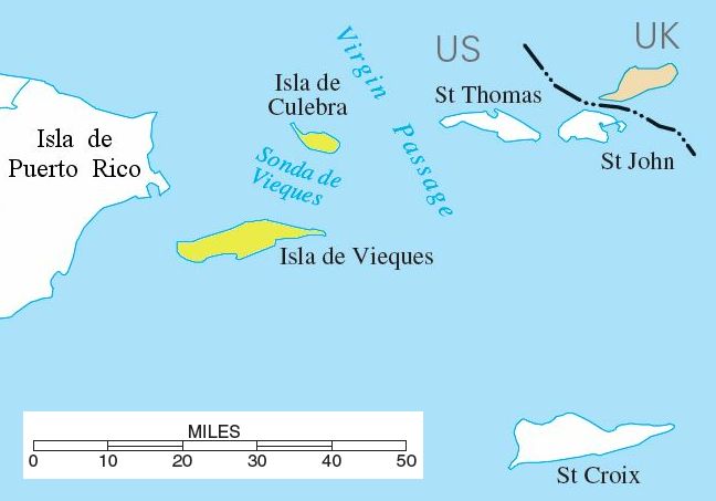
| حالي | 17:39، 10 أغسطس 2006 |  | 648 × 453 (30 كيلوبايت) | commonswiki>Eoghanacht | {{Information |Description= {{w|Spanish Virgin Islands}} with surrounding islands. {{coor dm|18|18|51|N|65|18|W|}}. |Source= National Atlas of the United States[http://nationalatlas.gov/printable/images/pdf/rivers/pagehyd_pr4.pdf] |Date= |Author= |Permiss |
استخدام الملف
ال1 ملف التالي مكررات لهذا الملف (المزيد من التفاصيل):
- ملف:Spanish-virgin-islands.jpg من ويكيميديا كومنز
الصفحة التالية تستخدم هذا الملف:


