|
تضامنًا مع حق الشعب الفلسطيني |
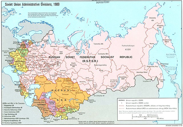
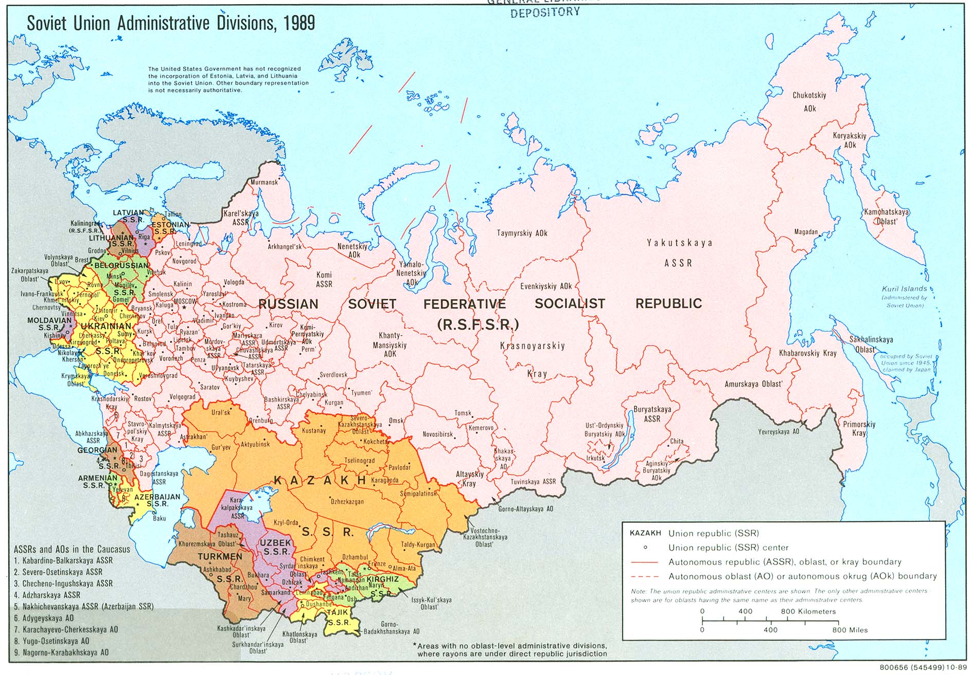
ملف:Soviet Union Administrative Divisions 1989.jpg
اذهب إلى التنقل
اذهب إلى البحث

حجم هذه المعاينة: 800 × 557 بكسل. الأبعاد الأخرى: 320 × 223 بكسل | 640 × 445 بكسل | 1٬024 × 713 بكسل | 1٬280 × 891 بكسل | 1٬887 × 1٬313 بكسل.
الملف الأصلي (1٬887 × 1٬313 بكسل حجم الملف: 397 كيلوبايت، نوع MIME: image/jpeg)
| هذا ملف من ويكيميديا كومنز. معلومات من صفحة وصفه مبينة في الأسفل. كومنز مستودع ملفات ميديا ذو رخصة حرة. |
ملخص
| الوصف |
English: An American map of Soviet Union Administrative Divisions c.1989 |
||
| المصدر |
|
||
| المؤلف | |||
| إصدارات أخرى |
|


ترخيص
| هذا العمل مِن مَجمُوعة في مكتبة الكونغرس، وفقاً للمكتبة، ليس هناك قيود معروفة لحقوق التَّأليف والنَّشر مُرتبِطة باستخدام هذا العمل. |  |
تاريخ الملف
اضغط على زمن/تاريخ لرؤية الملف كما بدا في هذا الزمن.
| زمن/تاريخ | صورة مصغرة | الأبعاد | مستخدم | تعليق | |
|---|---|---|---|---|---|
| حالي | 18:21، 17 مايو 2019 | | 1٬887 × 1٬313 (397 كيلوبايت) | commonswiki>Claude Zygiel | Removed stains |
استخدام الملف
ال1 ملف التالي مكررات لهذا الملف (المزيد من التفاصيل):
- ملف:Soviet Union Administrative Divisions 1989.jpg من ويكيميديا كومنز
الصفحة التالية تستخدم هذا الملف: