|
تضامنًا مع حق الشعب الفلسطيني |
ملف:South American plates.png
اذهب إلى التنقل
اذهب إلى البحث

حجم هذه المعاينة: 607 × 600 بكسل. الأبعاد الأخرى: 243 × 240 بكسل | 486 × 480 بكسل | 777 × 768 بكسل | 1٬036 × 1٬024 بكسل | 2٬288 × 2٬261 بكسل.
الملف الأصلي (2٬288 × 2٬261 بكسل حجم الملف: 1٬005 كيلوبايت، نوع MIME: image/png)
| هذا ملف من ويكيميديا كومنز. معلومات من صفحة وصفه مبينة في الأسفل. كومنز مستودع ملفات ميديا ذو رخصة حرة. |
Any autoconfirmed user can overwrite this file from the same source. Please ensure that overwrites comply with the guideline.
ملخص
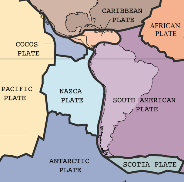
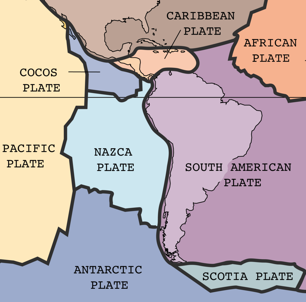
| الوصف | The key principle of plate tectonics is that the lithosphere exists as separate and distinct tectonic plates, which float on the fluid-like (visco-elastic solid) asthenosphere. The relative fluidity of the asthenosphere allows the tectonic plates to undergo motion in different directions. This map shows 15 of the largest plates. Note that the Indo-Australian Plate may be breaking apart into the Indian and Australian plates, which are shown separately on this map. |
| التاريخ | |
| المصدر | http://pubs.usgs.gov/publications/text/slabs.html |
| المؤلف | USGS; cropped by Beyond My Ken (talk) 10:06, 27 February 2010 (UTC) |
| إصدارات أخرى |
|


تقع هذه الصُّورة في النِّطاق العامّ لأنَّها تحتوي مواد حصريَّة مِن إِنتاج هيئة المساحة الجيولوجيَّة الأمريكيَّة في وزارة الداخلية في الولايات المُتحدة الأمريكيَّة. للمزيد مِن المعلومات انظر سياسية حقوق التَّأليف والنَّشر في موقع هيئة المساحة الجيولوجيَّة الأمريكيَّة الرسميَّة.
|
تاريخ الملف
اضغط على زمن/تاريخ لرؤية الملف كما بدا في هذا الزمن.
| زمن/تاريخ | صورة مصغرة | الأبعاد | مستخدم | تعليق | |
|---|---|---|---|---|---|
| حالي | 04:19، 1 سبتمبر 2024 | | 2٬288 × 2٬261 (1٬005 كيلوبايت) | commonswiki>RXFADEZ | restored Hispaniola to be a single island. Tried to preserve image format otherwise. Higher resolution |
استخدام الملف
ال1 ملف التالي مكررات لهذا الملف (المزيد من التفاصيل):
- ملف:South American plates.png من ويكيميديا كومنز
الصفحة التالية تستخدم هذا الملف: