|
تضامنًا مع حق الشعب الفلسطيني |
ملف:PRVSSIA1576Casparo Henneberg.png
الملف الأصلي (2٬973 × 2٬289 بكسل حجم الملف: 4٫5 ميجابايت، نوع MIME: image/png)
| هذا ملف من ويكيميديا كومنز. معلومات من صفحة وصفه مبينة في الأسفل. كومنز مستودع ملفات ميديا ذو رخصة حرة. |
| الوصف |
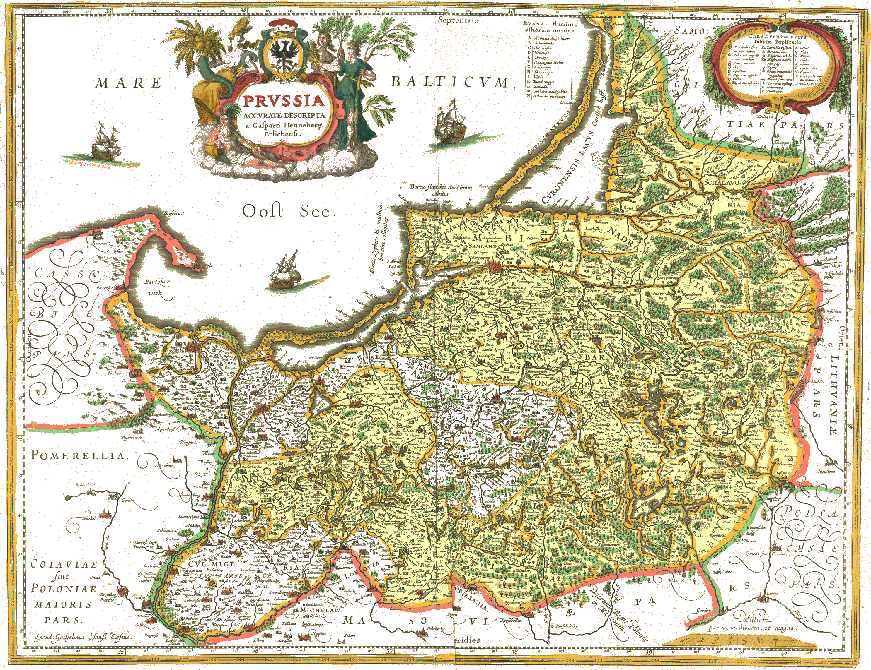
Deutsch: Karte von Preußen, gedruckt von Willem Blaeu im Jahre 1645, nach den 1576 in Elbing gedruckten Holzschnitten von Caspar Henneberg von Erlich (* 1529, † 1600).
Blaeus Druck von 1645 hat farbige Konturbänder aber keine Flächenfarbe. Auffälligkeiten: Die beiden Teile Preußens sind farblich nicht unterschieden, obwohl 1569 der westliche Teil Preußens unter Schirmherrschaft der polnischen Krone gekommen war, und der östliche Teil, das Herzogtum, lehensabhängig war, beide Teile Preußens jedoch per Vertrag eine gemeinsame Grenze gegen die Nachbarländer behielten. Die Nachbargebiete sind in unterschiedlichen Farben umrahmt, obwohl sie zur Rzeczpospolita gehörten. Schließlich ist Pommerellen nicht als Teil Preußens dargestellt, sondern als Teil Großpolens oder Kujawiens. Einige Namen sind zweisprachig angegeben, so "Bramberg / Bedgosky" (Bromberg / Bydgoszcz), oder als Kompromiss wie "Dantzk". English: Map of Prussia before it gave its name to the state of Prussia, printed by Willem Blaeu in 1645. The original woodcuts were printed in Elbląg (at that time Elbing) in 1576 by Caspar Henneberg von Erlich (1529 - 1600). Blaeu's 1645 print has colored outlines but no area coloration. Interesting details: The two fractions of Prussia have the same coloration, though the western (royal Polish Prussia) fractions was in 1569 declared (and contested) as part of the Polish-Lithuanian Rzeczpospolita, while the eastern (ducal) part was only a vassal of the crown (king) of Poland. Both parts of Prussia retained by contracts one common border against neighboring countries. The neighboring territories, all of them parts of the Rzeczpospolita, are marked by different colors. Last not least Pomerella is not shown as a part of Prussia, but as a part of Greater Poland (which was one of the Polish provinces). A few names are noted bilingually, such as "Bramberg / Bedgosky" (Bromberg / Bydgoszcz), or as a compromise like "Dantzk". |
||||||||||||||||
| التاريخ | |||||||||||||||||
| المصدر | Image:Blaeu 1645 - Prussia.jpg | ||||||||||||||||
| المؤلف |
|
||||||||||||||||
| الترخيص (إعادة استخدام هذا الملف) |
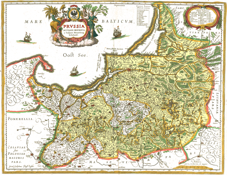
Deutsch: Diese Version wurde in folgender Weise bearbeitet: Entfernt wurden die Vergilbung des Papiers und, so gut es ging, der Schattenwurf von Knitterfalten. Die Farben der Konturbänder wurden aufgefrischt ohne ihre Lokalisation zu verändern. Weil die als schwarze Punktreihe markierte Grenze zwischen Herzoglichem und Königlichem Preußen in derselben Farbe hervorgehoben ist wie einige Gewässerufer des Landes und die Hervorhebung als Grenze entlang des Flusses Sorge fehlt, wurde das herzogliche Preußen in der Bearbeitung mit einer blassgelben Flächenfarbe hervorgehoben. Die nachträgliche farbliche Hervorhebung der Grenze in der Region "Lubuvia", Stadt "Lobaw" ist fehlerhaft. Die Grenzziehung muss wieter östlich erfolgen, sehe gepunktete Linie Nähe "Lewalde", "Gilgenaw" in orginal ohne nachträgliche farbliche Hervorhebung |
||||||||||||||||
|
هذه الصورة هي إعادة إنتاج خالصة لعمل فني ثنائي الأبعاد وبالتالي فلا يمكن أن يكون لها حقوق نشر وتأليف بنفسها في الولايات المتحدة حسب قضية مكتبة فنون بريدجمان ضد شركة كورل؛ المسألة قانونية أيضاً في العديد من الدول الأخرى، بما في ذلك ألمانيا.
العمل الأصلي ثنائي الأبعاد المعروض في هذه الصورة هو محتوى حر بسبب:
لذا فإنَّ إعادة الإنتاج هذه تخضع أيضاً لنفس الشروط كما هو الحال مع العمل الأصلي.
| ||||
تاريخ الملف
اضغط على زمن/تاريخ لرؤية الملف كما بدا في هذا الزمن.
| زمن/تاريخ | صورة مصغرة | الأبعاد | مستخدم | تعليق | |
|---|---|---|---|---|---|
| حالي | 15:37، 14 يناير 2022 | | 2٬973 × 2٬289 (4٫5 ميجابايت) | commonswiki>Ulamm | Bisher übersehene Grenzabschnitte bei "Gilgenaw" und "G. Lentzke" berücksichtigt, die die Ostgrenze des zum Königlich polnischen Preußen gehörenden "Lobovia" markieren. |
استخدام الملف
ال1 ملف التالي مكررات لهذا الملف (المزيد من التفاصيل):
- ملف:PRVSSIA1576Casparo Henneberg.png من ويكيميديا كومنز
الصفحتان التاليتان تستخدمان هذا الملف: