|
تضامنًا مع حق الشعب الفلسطيني |
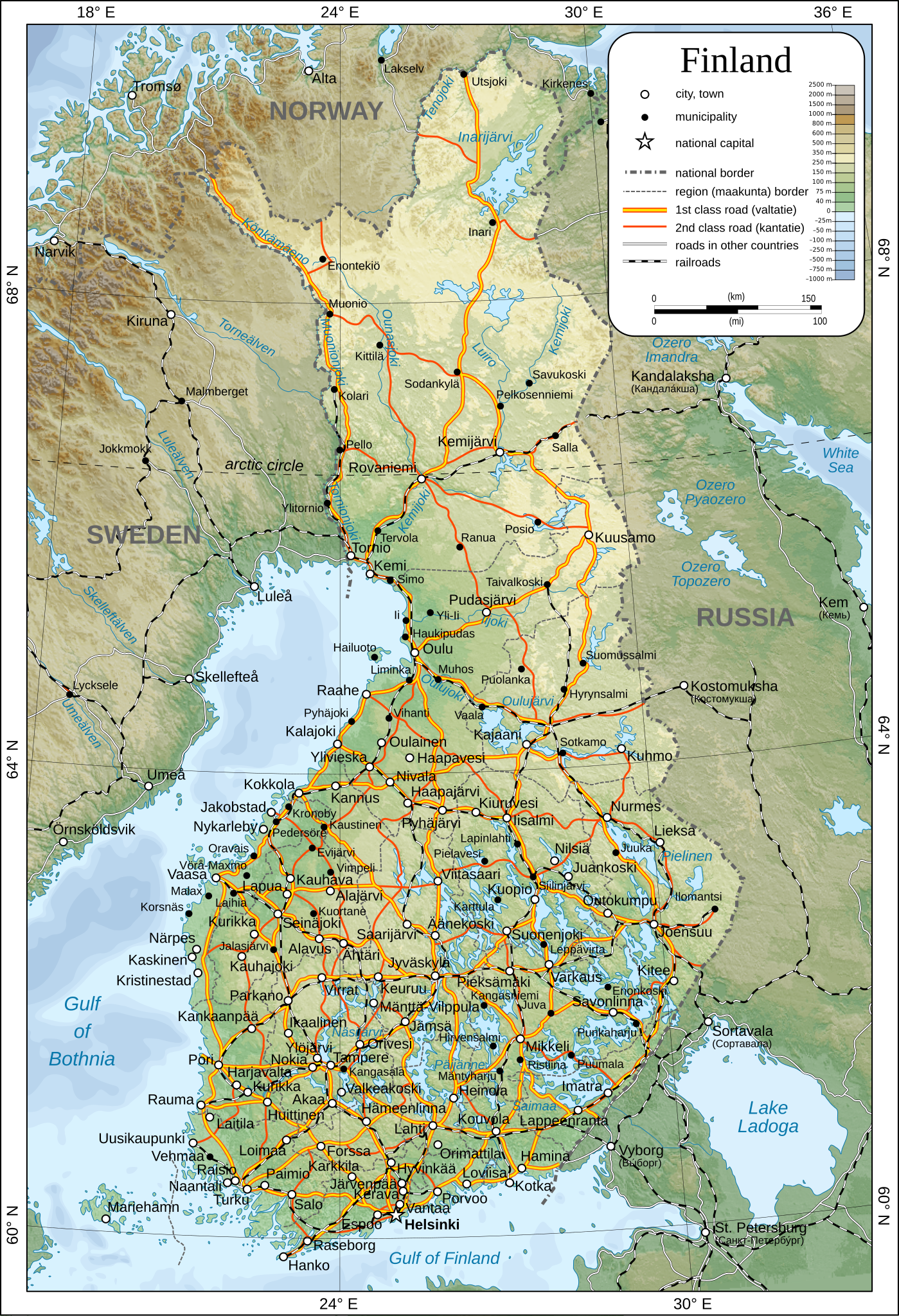
ملف:Map of Finland-en.svg
اذهب إلى التنقل
اذهب إلى البحث

حجم معاينة PNG لذلك الملف ذي الامتداد SVG: 409 × 599 بكسل. الأبعاد الأخرى: 164 × 240 بكسل | 328 × 480 بكسل | 524 × 768 بكسل | 699 × 1٬024 بكسل | 1٬399 × 2٬048 بكسل | 1٬371 × 2٬007 بكسل.
الملف الأصلي (ملف SVG، أبعاده 1٬371 × 2٬007 بكسل، حجم الملف: 3٫57 ميجابايت)
| هذا ملف من ويكيميديا كومنز. معلومات من صفحة وصفه مبينة في الأسفل. كومنز مستودع ملفات ميديا ذو رخصة حرة. |
ملخص
| الوصف |
English: Map of Finland.
Suomi: Suomen kartta.
Svenska: Karta över Finland.
|
| التاريخ | |
| المصدر | عمل شخصي |
| المؤلف | Oona Räisänen |
| الترخيص (إعادة استخدام هذا الملف) |
See below. I've worked hard to create this map, so even though not mandatory, please attribute me wherever it is suitable. |
| إصدارات أخرى |
[]
|
| SVG منشأ الملف |


ترخيص
| أنا، مالِك حقوق تأليف ونشر هذا العمل، أجعله في النِّطاق العامِّ، يسري هذا في أرجاء العالم كلِّه. في بعض البلدان، قد يكون هذا التَّرخيص غيرَ مُمكنٍ قانونيَّاً، في هذه الحالة: أمنح الجميع حق استخدام هذا العمل لأي غرض دون أي شرط ما لم يفرض القانون شروطًا إضافية. |
تاريخ الملف
اضغط على زمن/تاريخ لرؤية الملف كما بدا في هذا الزمن.
| زمن/تاريخ | صورة مصغرة | الأبعاد | مستخدم | تعليق | |
|---|---|---|---|---|---|
| حالي | 17:44، 26 ديسمبر 2009 | | 1٬371 × 2٬007 (3٫57 ميجابايت) | commonswiki>Mysid | added some cities, municipalities, and height color legend |
استخدام الملف
ال1 ملف التالي مكررات لهذا الملف (المزيد من التفاصيل):
- ملف:Map of Finland-en.svg من ويكيميديا كومنز
الصفحة التالية تستخدم هذا الملف: