|
تضامنًا مع حق الشعب الفلسطيني |
ملف:Location Ardennes.PNG
اذهب إلى التنقل
اذهب إلى البحث
لا توجد دقة أعلى متوفرة.
Location_Ardennes.PNG (506 × 439 بكسل حجم الملف: 40 كيلوبايت، نوع MIME: image/png)
| هذا ملف من ويكيميديا كومنز. معلومات من صفحة وصفه مبينة في الأسفل. كومنز مستودع ملفات ميديا ذو رخصة حرة. |
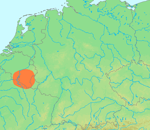
| الوصف | Locator maps for mountain ranges : Location Ardennes.PNG |
| المصدر | demis maps, see below |
| المؤلف | 13:44, 29 June 2007 (UTC) |
This image is in the public domain because it came from the site https://www.demis.nl/products/web-map-server/examples/ and was released by the copyright holder. Permission is granted to copy, distribute and/or modify this map since it is based on free of copyright images from: www.demis.nl. See also approval email on de.wp and its clarification.
|
| This work has been released into the public domain by its copyright holder, www.demis.nl. This applies worldwide. في بعض البلدان، قد يكون هذا التَّرخيص غيرَ مُمكنٍ قانونيَّاً، في هذه الحالة: يمنح www.demis.nl الجميع حق استخدام هذا العمل لأي غرض دون أي شرط ما لم يفرض القانون شروطًا إضافية.
|
تاريخ الملف
اضغط على زمن/تاريخ لرؤية الملف كما بدا في هذا الزمن.
| زمن/تاريخ | صورة مصغرة | الأبعاد | مستخدم | تعليق | |
|---|---|---|---|---|---|
| حالي | 17:42، 29 يونيو 2007 | | 506 × 439 (40 كيلوبايت) | commonswiki>Michiel1972 | {{Information |Description=Locator maps for mountain ranges : {{subst:PAGENAME}} |Source=demis maps, see below |Date= |Author={{Statistics Netherlands map}} |Permission=see below |other_versions= }} {{PD-Demis}} [[Category:Maps of mountain_ranges_of_Eu |
استخدام الملف
ال1 ملف التالي مكررات لهذا الملف (المزيد من التفاصيل):
- ملف:Location Ardennes.PNG من ويكيميديا كومنز
الصفحة التالية تستخدم هذا الملف: