|
تضامنًا مع حق الشعب الفلسطيني |
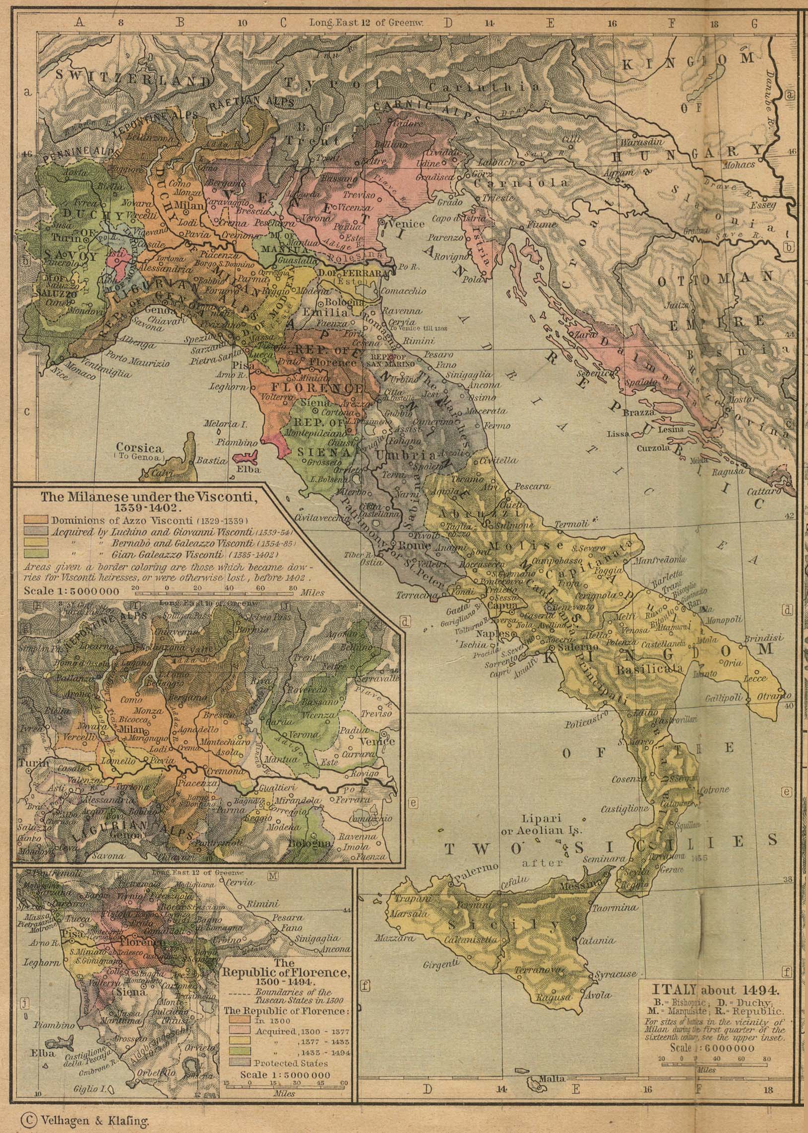
ملف:Italy 1494 shepherd.jpg

الملف الأصلي (1٬629 × 2٬282 بكسل حجم الملف: 1٫39 ميجابايت، نوع MIME: image/jpeg)
| هذا ملف من ويكيميديا كومنز. معلومات من صفحة وصفه مبينة في الأسفل. كومنز مستودع ملفات ميديا ذو رخصة حرة. |

ملخص
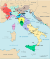
Italy about 1494
[]
- images with some factual accuracy disputed (names, borders, etc.); see File talk:Italy 1494.svg but some characteristics solved over the previous version (image gallery below)
-
 català
 -
 Deutsch
 -
 English
 -
 English, original, accuracy disputed too
 -
 español
 -
 français
 -
 italiano
 -
 ua
ua


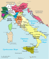
- images of the same period with factual accuracy disputed (names, borders, etc.); see File talk:Italy 1494.svg and File talk:Map of Italy (1494)-it.svg
-
 català
 -
 italiano
 -
 English
 -
 polski
 -
 македонски
-ca.svg)
-it.svg)
-en.svg)
-pl.svg)
-mk.svg)
- another version of the same period with same factual accuracy disputed (names, borders, etc.) mostly based on Shepherd (original JPG) image
[]
PNG:
-
 العربية
 -
 الإنجليزية
 -
 اليونانية


SVG:
-
 الكتالانية
 -
 الإسبانية
 -
 الفرنسية
 -
 الإيطالية
 -
 الهنغارية


See similar versions (disputed too): Map of Italy (1494)
- Other years
-
1494
-
 1796
1796 -
 1843
1843 -
 1861
1861 -
 1864
1864 -
 1870
1870


-it.svg)
Source
Historical Atlas by William Shepherd from the Perry-Castañeda Library Map Collection, University of Texas at Austin
The original image is in the public domain (book published in 1911), and UT has released their archive of images from the book into the public domain as well.
ترخيص
|
هذه الصورة هي إعادة إنتاج خالصة لعمل فني ثنائي الأبعاد وبالتالي فلا يمكن أن يكون لها حقوق نشر وتأليف بنفسها في الولايات المتحدة حسب قضية مكتبة فنون بريدجمان ضد شركة كورل؛ المسألة قانونية أيضاً في العديد من الدول الأخرى، بما في ذلك ألمانيا.
العمل الأصلي ثنائي الأبعاد المعروض في هذه الصورة هو محتوى حر بسبب:
لذا فإنَّ إعادة الإنتاج هذه تخضع أيضاً لنفس الشروط كما هو الحال مع العمل الأصلي.
| ||||
تاريخ الملف
اضغط على زمن/تاريخ لرؤية الملف كما بدا في هذا الزمن.
| زمن/تاريخ | صورة مصغرة | الأبعاد | مستخدم | تعليق | |
|---|---|---|---|---|---|
| حالي | 12:13، 14 مايو 2023 | | 1٬629 × 2٬282 (1٫39 ميجابايت) | commonswiki>Sepultura | Jobb. |
استخدام الملف
ال1 ملف التالي مكررات لهذا الملف (المزيد من التفاصيل):
- ملف:Italy 1494 shepherd.jpg من ويكيميديا كومنز
الصفحتان التاليتان تستخدمان هذا الملف: