|
تضامنًا مع حق الشعب الفلسطيني |
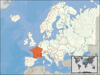
ملف:Europe location FRA.png
اذهب إلى التنقل
اذهب إلى البحث

حجم هذه المعاينة: 800 × 600 بكسل. الأبعاد الأخرى: 320 × 240 بكسل | 640 × 480 بكسل | 1٬024 × 768 بكسل | 1٬280 × 960 بكسل | 1٬600 × 1٬200 بكسل.
الملف الأصلي (1٬600 × 1٬200 بكسل حجم الملف: 712 كيلوبايت، نوع MIME: image/png)
| هذا ملف من ويكيميديا كومنز. معلومات من صفحة وصفه مبينة في الأسفل. كومنز مستودع ملفات ميديا ذو رخصة حرة. |
| الوصف | ||||
| التاريخ | ||||
| المصدر | عمل شخصي | |||
| المؤلف | User:David Liuzzo | |||
| الترخيص (إعادة استخدام هذا الملف) |
|

تاريخ الملف
اضغط على زمن/تاريخ لرؤية الملف كما بدا في هذا الزمن.
| زمن/تاريخ | صورة مصغرة | الأبعاد | مستخدم | تعليق | |
|---|---|---|---|---|---|
| حالي | 17:13، 1 يناير 2007 | | 1٬600 × 1٬200 (712 كيلوبايت) | commonswiki>David Liuzzo | {{Europe location| |Staat=der französischen Republik |State=France |Date=01.01.2007 |other_versions=See Category:Locator maps for EU countries }} |
استخدام الملف
ال1 ملف التالي مكررات لهذا الملف (المزيد من التفاصيل):
- ملف:Europe location FRA.png من ويكيميديا كومنز
الصفحة التالية تستخدم هذا الملف: