|
تضامنًا مع حق الشعب الفلسطيني |
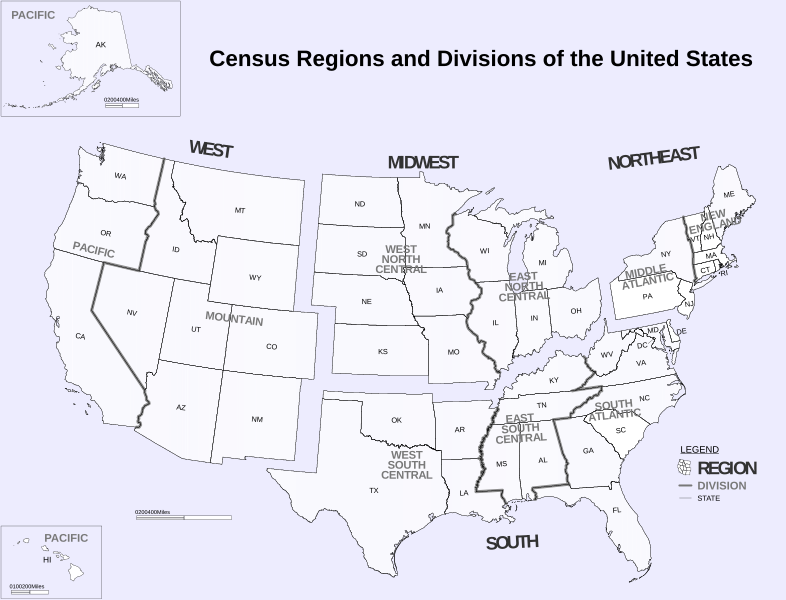
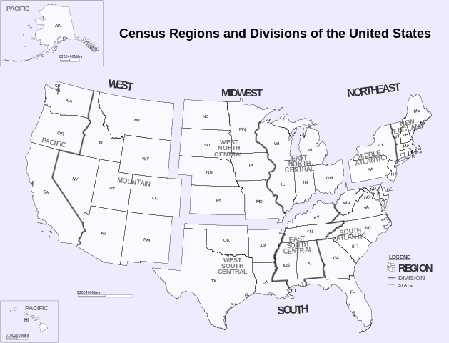
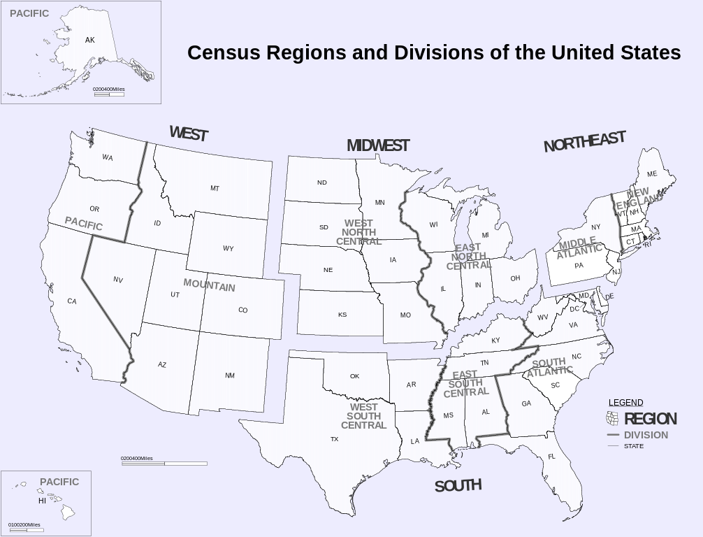
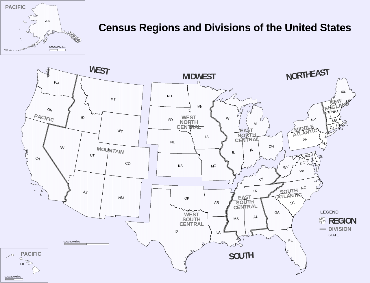
ملف:Census Regions and Division of the United States.svg
اذهب إلى التنقل
اذهب إلى البحث

حجم معاينة PNG لذلك الملف ذي الامتداد SVG: 786 × 600 بكسل. الأبعاد الأخرى: 315 × 240 بكسل | 629 × 480 بكسل | 1٬006 × 768 بكسل | 1٬280 × 977 بكسل | 2٬560 × 1٬954 بكسل | 942 × 719 بكسل.
الملف الأصلي (ملف SVG، أبعاده 942 × 719 بكسل، حجم الملف: 1٫27 ميجابايت)
| هذا ملف من ويكيميديا كومنز. معلومات من صفحة وصفه مبينة في الأسفل. كومنز مستودع ملفات ميديا ذو رخصة حرة. |
ملخص
| الوصف |
English: Census Regions and Division of the United States. |
| التاريخ | (from pdf) |
| المصدر | https://www2.census.gov/geo/pdfs/maps-data/maps/reference/us_regdiv.pdf |
| المؤلف | US Census Bureau |
| إصدارات أخرى | File:Census Regions and Divisions.PNG |
| SVG منشأ الملف |
ترخيص
This image or file is a work of a United States Census Bureau employee, taken or made as part of that person's official duties. As a work of the U.S. federal government, the image is in the public domain.
|
 |
تاريخ الملف
اضغط على زمن/تاريخ لرؤية الملف كما بدا في هذا الزمن.
| زمن/تاريخ | صورة مصغرة | الأبعاد | مستخدم | تعليق | |
|---|---|---|---|---|---|
| حالي | 10:02، 6 نوفمبر 2018 | | 942 × 719 (1٫27 ميجابايت) | commonswiki>JoKalliauer | phab:35245 multiple xkoordinates |
استخدام الملف
ال1 ملف التالي مكررات لهذا الملف (المزيد من التفاصيل):
- ملف:Census Regions and Division of the United States.svg من ويكيميديا كومنز
الصفحة التالية تستخدم هذا الملف: