|
تضامنًا مع حق الشعب الفلسطيني |
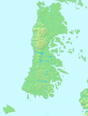
ملف:Archipiélago de Chiloé-blank.PNG
اذهب إلى التنقل
اذهب إلى البحث

حجم هذه المعاينة: 456 × 599 بكسل. الأبعاد الأخرى: 182 × 240 بكسل | 365 × 480 بكسل | 584 × 768 بكسل | 1٬100 × 1٬446 بكسل.
الملف الأصلي (1٬100 × 1٬446 بكسل حجم الملف: 1٬017 كيلوبايت، نوع MIME: image/png)
| هذا ملف من ويكيميديا كومنز. معلومات من صفحة وصفه مبينة في الأسفل. كومنز مستودع ملفات ميديا ذو رخصة حرة. |
| الوصف | |||||
| التاريخ | |||||
| المصدر |
Español: Mapa en el dominio público English: PD map |
||||
| المؤلف | Lin linao | ||||
| الترخيص (إعادة استخدام هذا الملف) |
|
تاريخ الملف
اضغط على زمن/تاريخ لرؤية الملف كما بدا في هذا الزمن.
| زمن/تاريخ | صورة مصغرة | الأبعاد | مستخدم | تعليق | |
|---|---|---|---|---|---|
| حالي | 23:15، 1 ديسمبر 2011 | | 1٬100 × 1٬446 (1٬017 كيلوبايت) | commonswiki>Lin linao | Mejora de resolución y corrección de las bahías y fiordos que estaban marcados como cuerpos de agua interior. |
استخدام الملف
ال1 ملف التالي مكررات لهذا الملف (المزيد من التفاصيل):
- ملف:Archipiélago de Chiloé-blank.PNG من ويكيميديا كومنز
ال17 صفحة التالية تستخدم هذا الملف:
- كنائس تشيلوي
- كنيسة آلداتشيلدو
- كنيسة إتشواك
- كنيسة بيلوبويي
- كنيسة تشونتشي
- كنيسة تشيلين
- كنيسة ديتيف
- كنيسة سان خوان باوتيستا (دالكاوي)
- كنيسة سان فرانثيسكو (كاسترو)
- كنيسة سانتا ماريا دي ريلان
- كنيسة سانتا ماريا دي لوريتو (آتشاو)
- كنيسة سيدة الأحزان (دالكاوي)
- كنيسة سيدة جراثيا دي نيركون
- كنيسة كاجواتش
- كنيسة كولو
- كنيسة كينتشاو
- قالب:Location map Chiloé