|
تضامنًا مع حق الشعب الفلسطيني |
قالب:Location map Antigua/doc
اذهب إلى التنقل
اذهب إلى البحث

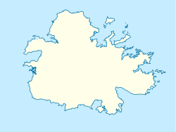
Map of Antigua and Barbuda

Template:Location map Antigua is a location map definition used to overlay markers and labels on an إسقاط متساوي المستطيلات map of أنتيغوا، لاس بالماس. The markers are placed by عرض جغرافي and طول جغرافي coordinates on the default map or a similar map image.
الاستخدام
These definitions are used by the following templates when invoked with parameter "Antigua":
{{خريطة مواقع| Antigua | ...}}{{Location map many| Antigua | ...}}{{خريطة مواقع+| Antigua | ...}}{{خريطة مواقع~| Antigua | ...}}
Map definition
- name = Antigua
- Name used in the default map caption
- image = Antigua location map.svg
- The default map image, without "Image:" or "File:"
- top = 17.184
- عرض جغرافي at top edge of map, in decimal degrees
- bottom = 16.957
- Latitude at bottom edge of map, in decimal degrees
- left = -61.948
- طول جغرافي at left edge of map, in decimal degrees
- right = -61.634
- Longitude at right edge of map, in decimal degrees
Examples using location map templates
Location map
{{خريطة مواقع| Antigua
| width   = 250
| lat_deg = 17.117
| lon_deg = -61.85
| label   = St. John's
}}
Location map many
{{Location map many| Antigua
| width    = 250
| caption  = Two locations in Antigua
| lat1_deg = 17.117
| lon1_deg = -61.85
| label1   = St. John's
| lat2_deg = 17.0
| lon2_deg = -61.767
| label2   = English Harbour
}}
Location map+
{{خريطة مواقع+| Antigua
| width   = 250
| caption = Two locations in Antigua
| places  =
  {{خريطة مواقع~| Antigua
  | lat_deg = 17.117
  | lon_deg = -61.85
  | label   = St. John's
  }}
  {{خريطة مواقع~| Antigua
  | lat_deg = 17.0
  | lon_deg = -61.767
  | label   = English Harbour
  }}
}}
طالع أيضاً
- Location map templates
- قالب:خريطة مواقع, to display one mark and label using latitude and longitude
- قالب:Location map many, to display up to nine marks and labels
- Template:Location map+, to display an unlimited number of marks and labels
- Infobox templates incorporating (passing values to) the Location map template
List
- قالب:معلومات مطار — alternative map support: relief (via pushpin_relief) and AlternativeMap (via pushpin_image)
- قالب:معلومات موقع أثري قديم — alternative map support: relief
- قالب:معلومات عمل فني
- قالب:صندوق معلومات مبنى — alternative map support: relief
- قالب:صندوق معلومات كازينو
- قالب:Infobox castrum — alternative map support: relief (via map_relief)
- قالب:معلومات كهف (via Infobox map) — alternative map support: relief
- قالب:ص.م مقبرة
- قالب:خلاف مدني
- قالب:Infobox climbing route (via Infobox map) — alternative map support: relief
- قالب:معلومات كنسية — alternative map support: relief
- قالب:Infobox concentration camp
- قالب:ص.م سد — alternative map support: relief
- قالب:Infobox dava
- قالب:معلومات غابة (via Infobox map) — alternative map support: relief
- قالب:Infobox glacier (via Infobox map) — alternative map support: relief (displays relief image unless map_relief=0)
- قالب:Infobox golf facility — alternative map support: relief
- قالب:صندوق معلومات موقع تاريخي — alternative map support: relief (via map_relief)
- قالب:معلومات مستشفى — alternative map support: relief
- قالب:Infobox hut — alternative map support: relief
- قالب:صندوق معلومات منارة — alternative map support: relief
- قالب:معلومات خريطة (used by other infoboxes) — alternative map support: relief
- قالب:معلومات نزاع عسكري — alternative map support: relief (via map_relief)
- قالب:قاعدة عسكرية — alternative map support: relief (via map_relief)
- قالب:معلومات دير
- قالب:ص.م جبل (via Infobox map) — alternative map support: relief (displays relief image unless map_relief=0)
- قالب:صندوق معلومات ممر جبلي (via Infobox map) — alternative map support: relief (displays relief image unless map_relief=0)
- قالب:ص.م جبل (via Infobox map) — alternative map support: relief (displays relief image unless map_relief=0)
- قالب:صندوق معلومات متحف — alternative map support: relief (via map_relief)
- قالب:ص.م حقل نفط — alternative map support: relief
- قالب:معلومات مصفاة نفط — alternative map support: relief
- قالب:Infobox military operation
- قالب:Infobox park (via Infobox map) — alternative map support: relief
- قالب:ص.م محطة نووية — alternative map support: relief
- قالب:صندوق معلومات منطقة محمية (via Infobox map) — alternative map support: relief
- قالب:صندوق معلومات مفاعل
- قالب:دار عبادة — alternative map support: relief
- قالب:صندوق معلومات مطعم
- قالب:Infobox Settlement — alternative map support: relief (via pushpin_relief) and AlternativeMap (via pushpin_image)
- قالب:Infobox spring (via Infobox map) — alternative map support: relief
- قالب:Infobox Hindu temple
- قالب:صندوق معلومات فوهة صدمية
- قالب:Infobox valley (via Infobox map) — alternative map support: relief
- قالب:معلومات شلال (via Infobox map) — alternative map support: relief
- قالب:ص.م موقع تراث عالمي — alternative map support: relief
