ملف:Lake Malawi seen from orbit.jpg
من أرابيكا، الموسوعة العربية الحرة
المزيد من الإجراءات
حجم هذه المعاينة: 459 × 599 بكسل. الأبعاد الأخرى: 184 × 240 بكسل | 367 × 480 بكسل | 588 × 768 بكسل | 784 × 1٬024 بكسل | 1٬568 × 2٬048 بكسل | 2٬778 × 3٬628 بكسل.
الملف الأصلي (2٬778 × 3٬628 بكسل حجم الملف: 3٫24 ميجابايت، نوع MIME: image/jpeg)
| هذا ملف من ويكيميديا كومنز. معلومات من صفحة وصفه مبينة في الأسفل. كومنز مستودع ملفات ميديا ذو رخصة حرة. |
ملخص
| الوصف |
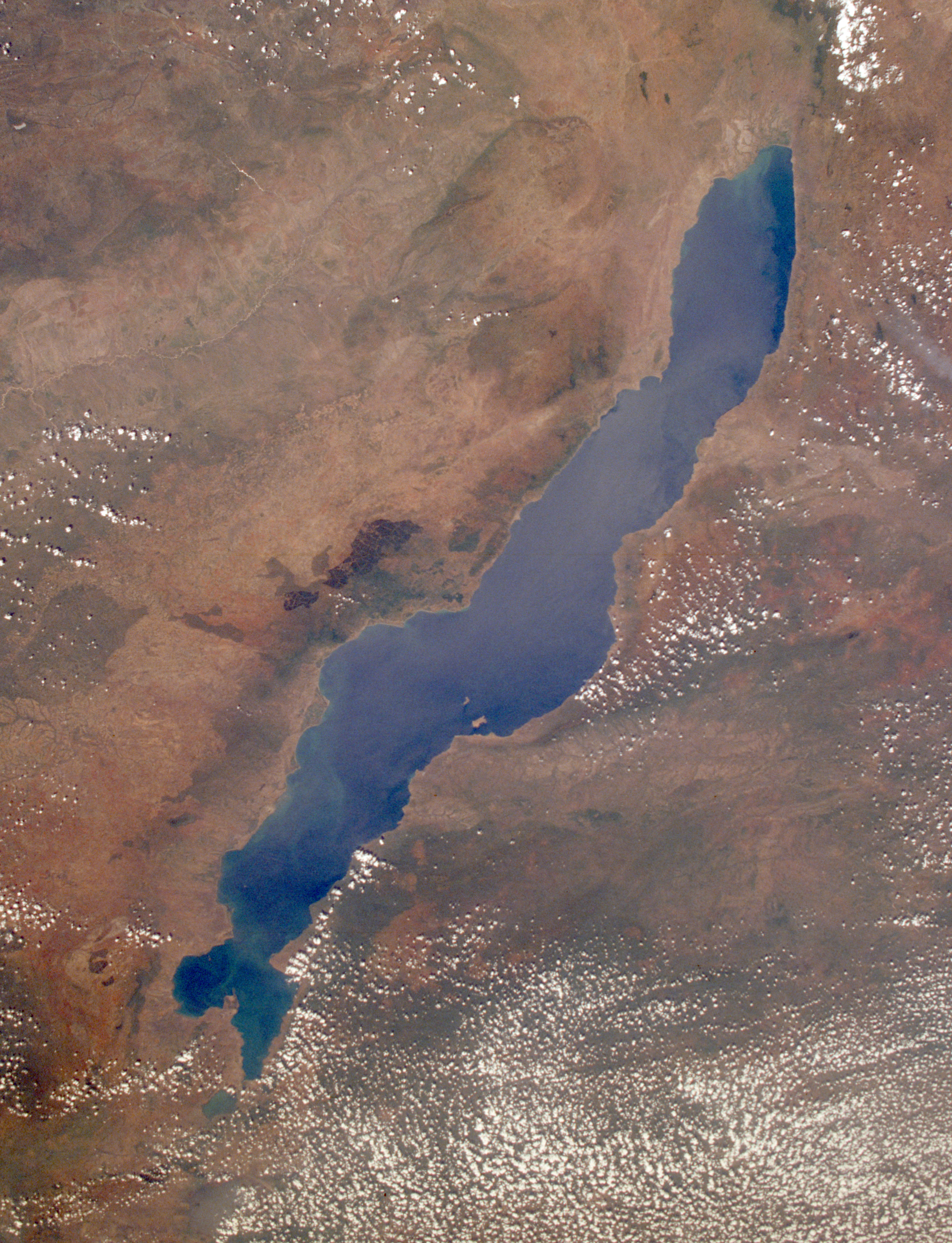
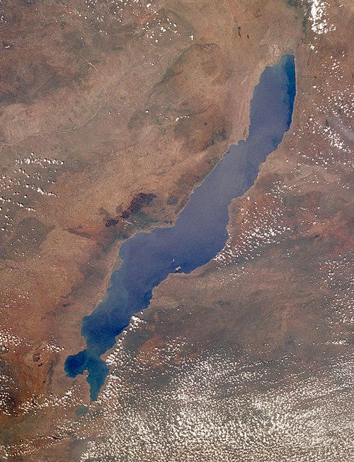
English: Lake Malawi, photographed by astronauts aboard the Space Shuttle. Original image courtesy of the Image Analysis Laboratory, NASA Johnson Space Center (eol.jsc.nasa.gov). Image ID: STS061-75-48. Image cropped, sharpened and gamma-corrected.
|
| التاريخ | التقطت في٣ ديسمبر ١٩٩٨, ٠٩:٤٩:٣١ UTC |
| المصدر | https://eol.jsc.nasa.gov/SearchPhotos/photo.pl?mission=STS061&roll=75&frame=48 |
| المؤلف | National Aeronautics and Space Administration (NASA) |
| إصدارات أخرى |

فُهرِست هذه الصُّورة أَو هذا التَّسجيل المرئي لدى مركز جونسون للفضاء التَّابعة لوكالة الفضاء الأَمريكيَّة (ناسا) تحت المُعرِّف STS061-75-48. لا يُشير هذه الوَسم إلى حالة حقوق التَّأليف والنَّشر الخاصَّة بالعمل المُرفَق؛ لا يزال وَسم حقوق التَّأليف والنَّشر مَطلُوباً، راجع كومنز:ترخيص لمزيدٍ من المعلومات. لغات أخرى:
|
ترخيص
يقع هذا الملفُّ في النِّطاق العامِّ في الولايات المُتحدة لأنَّه أُنشِئ مِن قبل مُختبر علوم الصُّور وتحليلها في مركز جُونسُون للفضاء التَّابِع لوَكالة الفضاء الأَمريكيَّة. تنصُّ سياسة حقوق التَّأليف والنَّشر لوَكالة الفضاء الأَمريكيَّة على أنَّ "المواد الَّتي تُنتجها الوَكالة غير مَحميَّةٍ بحقوق التَّأليف والنَّشر ما لم يُذكر خلاف ذلك". انظر (دليل استعمال الوسائِط الخاصِّ بالوَكالة أو شروط استعمال الصُّور الضُّوئِيَّة التي التقطها روَّاد الفضاء).
مَصدَر الصُّورة: STS061-75-48.
|
سجلُّ الرَّفع الأصيل
Uploaded to en wiki by User:Worldtraveller; moved here by User:Tintazul. Full original description follows.
تاريخ الملف
اضغط على زمن/تاريخ لرؤية الملف كما بدا في هذا الزمن.
| زمن/تاريخ | صورة مصغرة | الأبعاد | مستخدم | تعليق | |
|---|---|---|---|---|---|
| حالي | 23:17، 30 أغسطس 2019 | | 2٬778 × 3٬628 (3٫24 ميجابايت) | wikimediacommons>Ras67 | high resolution, cropped and rotated from NASA's original TIFF |
استخدام الملف
الصفحة التالية تستخدم هذا الملف: